
South Carolina ZIP Prefix Coverage
South Carolina postal codes begin with ten three-digit prefixes, from 290 through 299. These are useful for regional orientation, not a complete list of five-digit destinations. The prefixes span the Midlands, Upstate, Pee Dee and Lowcountry, and postal delivery areas can cross county or municipal lines. USPS updates the exact city and post-office association; no static official South Carolina-only five-digit table was exposed in the research. Read the rows below as a regional index, then verify a full ZIP with USPS.
| Prefix | Broad region | Example post office or area | Coverage note |
|---|---|---|---|
| 290xx | Central Midlands and nearby communities | Columbia-area and smaller post offices | Verify each five-digit match with USPS |
| 291xx | Columbia/Midlands and central or southern communities | Silverstreet 29145 is a USPS notice example | ZIP areas do not follow county lines |
| 292xx | Columbia metropolitan delivery | Columbia and PO/unique routes | Postal city is not the city limit |
| 293xx | Spartanburg, Upstate and nearby towns | Campobello 29322; Landrum 29356 | Other examples include Chesnee, Cowpens, Moore, Pauline and Roebuck |
| 294xx | Charleston, Lowcountry and coast | Green Pond 29446 is a USPS notice example | Postal city names may differ from municipality |
| 295xx | Florence/Pee Dee and coastal interior | Use USPS City State Product for exact names | Five-digit associations change in the current product |
| 296xx | Greenville, Anderson and Upstate | Abbeville 29620; Taylors 29687 | Also includes examples such as Belton, Marietta and Travelers Rest |
| 297xx | Rock Hill, York, Chester and Lancaster | South Carolina towns in the Charlotte processing region | Processing association does not change state location |
| 298xx | Aiken, Edgefield and upper Savannah River | Aiken 29801; Johnston 29832 | Other examples include Elko, Gloverville, Jackson and McCormick |
| 299xx | Beaufort, Hilton Head and Lowcountry coast | Island and coastal stations | Preferred postal city may differ from municipality or county |
These rows do not claim that every five-digit code or station is listed. In particular, the 297 prefix is associated with the Charlotte processing area despite being used in South Carolina, and some 298 operations connect with Augusta. Those processing relationships do not move an address out of South Carolina. Use the exact delivery address and USPS result rather than inferring a post office from the prefix alone.
For a current address, use the USPS City State Product description to understand the official ZIP, city and post-office associations.
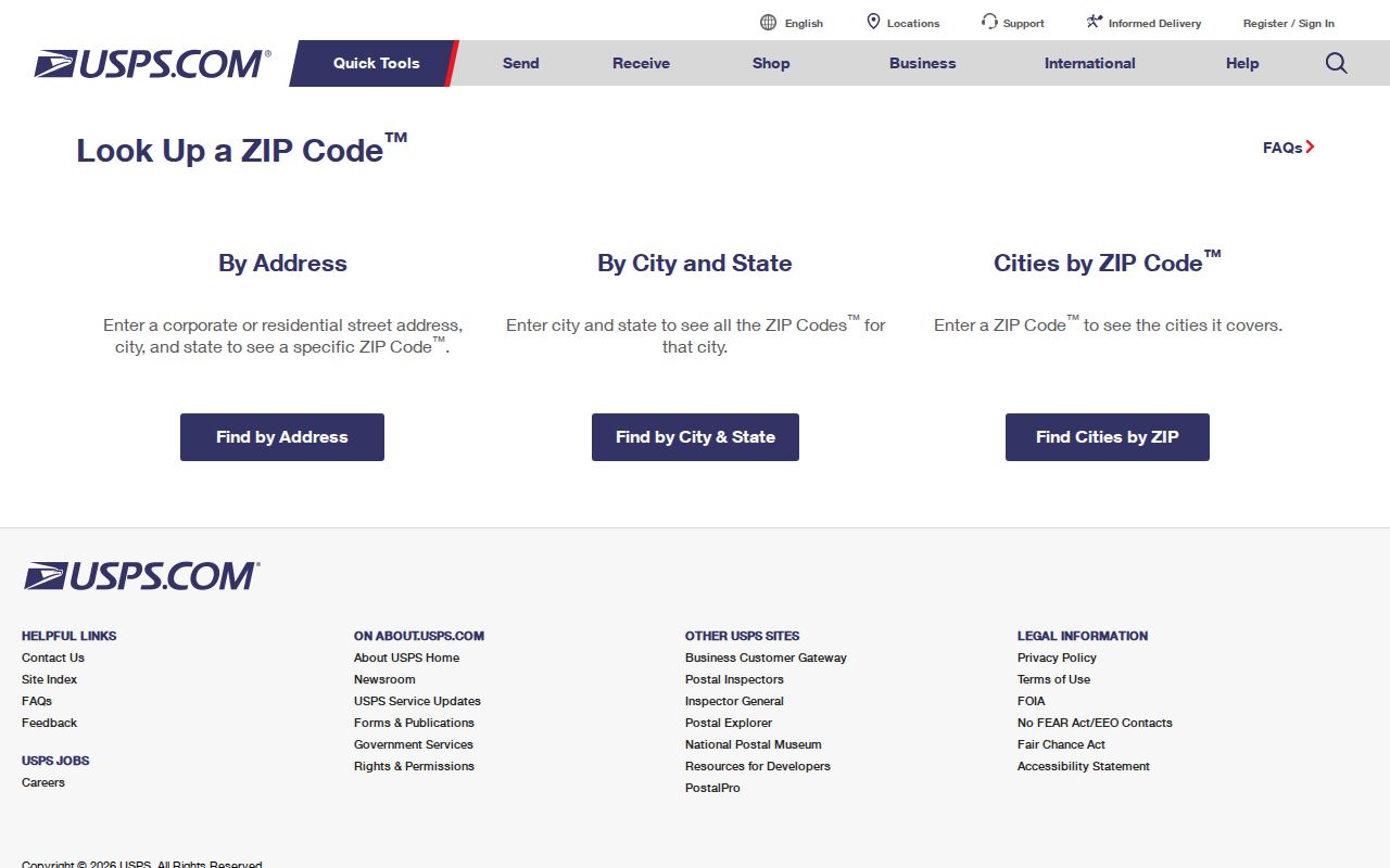
The USPS tool distinguishes address validation from a general city or ZIP lookup, and warns that a ZIP match does not verify a person or company.
USPS Three South Carolina ZIP Searches
The postal lookup offers three distinct routes. “By Address” takes the street address plus city and state, or street plus ZIP; add a unit number when several addresses match. “By City and State” requires both fields and returns recognized ZIPs for that city when available. “Cities by ZIP Code” requires a five-digit ZIP and returns associated cities or post offices. A postal city is USPS guidance, not a finding about municipal jurisdiction.
Use the mode that matches the information at hand:
- For a delivery point, enter the street and city/state, or street and ZIP. Include an apartment or unit if more than one match appears.
- For a city-wide postal list, enter both city and state and compare the recognized names returned by USPS.
- For a ZIP you already have, use the cities-by-ZIP option to see postal associations.
- Carry the normalized address to county GIS or the assessor to identify the parcel and jurisdiction.
USPS expressly cautions that a result does not confirm that a person or company is at an address. The ZIP lookup validates a delivery relationship, not residence or ownership.
South Carolina ZIP Geography by Region
The prefixes help orient a search across a large and varied state. The 290, 291 and 292 groups cover the central Midlands, including Columbia-area routes and smaller communities. The 293 and 296 groups serve the Upstate, with examples in the research ranging from Campobello, Chesnee, Cowpens and Landrum to Abbeville, Belton, Marietta, Ninety Six, Taylors and Travelers Rest. They are examples of postal associations, not a city-by-city census.
The 294 and 299 groups cover Charleston-area, coastal and island routes; Green Pond is one researched USPS example in the 294 range. The 295 group is associated with Florence and the Pee Dee, but exact five-digit city associations should be checked in the current USPS product. The 298 group reaches Aiken, Edgefield and upper Savannah River communities, including Aiken, Elko, Gloverville, Jackson, Johnston and McCormick.
South Carolina’s 297xx codes are a useful reminder that mail processing geography can cross state borders: the prefix is tied to the Charlotte processing region while the addresses remain in South Carolina. Augusta is also relevant to some 298 operations. Such relationships describe postal handling, not county, school, court or voting jurisdiction.
Find South Carolina Residents by ZIP
A ZIP can help narrow a resident search, but South Carolina’s official records do not provide one public, statewide list of everyone at that postal code. County assessors and GIS systems are not uniform. The inspected Charleston property search accepts name, street number/name and TMS, not a statewide ZIP browse. Other county portals may store a postal field, but check the selected county’s live options before assuming a filter exists.
- Confirm the address or ZIP with USPS and record the preferred postal city.
- Use the map or county boundary tool to identify the county and local jurisdiction.
- Search that county’s assessor or GIS by address, owner or parcel number; do not assume a ZIP-only query.
- Use a voter, court or permit source only through its own allowed fields and rules.
- Verify any owner or person match with the record that directly supports it.
Once a postal area is narrowed, the South Carolina street directory lookup can help with the street-level record chain. The statewide court roster accepts a county, city or ZIP only as a way to open the appropriate county or city portal; it does not return a resident list indexed by ZIP.
South Carolina Voter and Court ZIP Rules
MySCVotes does not accept a postal code as a substitute for a voter’s name, county and date of birth as shown on the registration card. Its individual lookup is not a reverse address search. The fuller voter file is available only to a registered South Carolina voter under S.C. Code §7-3-20(D)(13), and it has statutory use restrictions. Permitted list filters include county and voting districts as well as age, sex, race, household, election participation and registration date. Those are controlled file filters, not an open ZIP-based directory.
The statewide Court Roster page has a “County, City, or Zip Code” field, but that is a routing convenience. It selects a local roster destination; the county portal’s case search then follows its own labels and coverage. A court portal may miss municipal cases kept by a city clerk. Neither voter nor court results turn a ZIP into proof that a person lives inside a particular boundary.
Use the current South Carolina voter-list rules before seeking a full file. Lists can include address, precinct, districts and participation fields, but never reveal ballot choice. South Carolina does not register voters by party. Do not infer a person’s party from primary participation.
South Carolina Address District Maps
When the question is which public body serves an address, a district map is more useful than the ZIP alone. The South Carolina Revenue and Fiscal Affairs District Information tool accepts an address or map point to identify legislative, school, voting and special districts. Its result helps direct a record request to the right body; political and school boundaries can change and should be checked against current agency information.
Near a county line, the RFA County Boundary Clarifications resource can help establish the county relationship. County GIS and 911/addressing offices validate situs geography, while USPS assigns delivery city and ZIP. The assessor’s TMS or PIN identifies the tax parcel. Those identifiers solve different routing problems and may not match neatly on a rural or recently readdressed road.
Use the official RFA mapping resources for district questions, then verify ownership or a recorded legal interest with the county assessor and Register of Deeds.
South Carolina ZIP and City Boundaries
A South Carolina delivery address can use a post-office city different from the incorporated city, cross a county line, or sit in an unincorporated area. A rural address can receive mail from a neighboring town; an island or institution may have a special or PO-box-oriented route. Local courts, permits, police and tax offices follow their own jurisdictional lines. Confirm those lines with county GIS, the county boundary resource or the relevant municipal office rather than taking the postal city as a legal boundary.
This distinction matters for older searches too. ZIP codes belong to the postal era; deeds, directories, plats and census schedules can predate them. A street rename, reassigned number, annexation or historic district/county change may explain why the same address appears under a different jurisdiction. Use a former street name, subdivision, lot/block or map sheet when looking backward.
- ZIP+4
- The five-digit ZIP plus four digits used to sort mail to a more specific delivery segment.
- PO-box ZIP
- A ZIP assigned to a post office box service rather than a broad street-delivery area.
- Unique ZIP
- A code assigned to one large organization or institution.
- Carrier route
- A mail carrier’s delivery grouping; it does not define a city or property line.
Verify a South Carolina Parcel Separately
A postal result answers whether USPS recognizes an address format and its ZIP association. It does not confirm an occupant, owner, parcel boundary, school assignment or court venue. For property, follow the address to county GIS and assessor records; for a recorded transfer, use the county Register of Deeds. The assessor may show a tax owner and mailing address, which can differ from the person who receives mail at the situs.
The ZIP code directory is most helpful as an orientation layer. It helps normalize a delivery address and points toward a likely local office, but each source must be checked for its own coverage and date. If the parcel card and postal record disagree on city or ZIP, preserve both values and ask the relevant county addressing or postal office which field governs the question at hand.
Separate the questions. USPS confirms postal format. County GIS locates a parcel. The assessor reports tax fields. The Register of Deeds records instruments. None of those records alone proves who currently occupies a home.